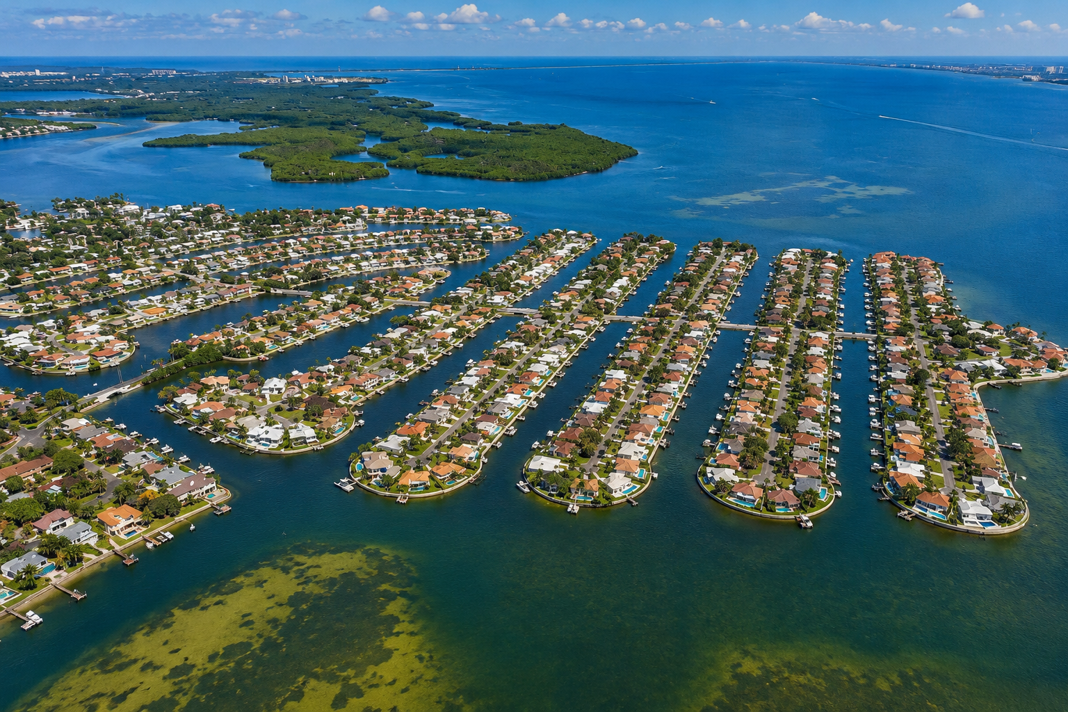
How Deep Are the Canals in Venetian Isles & Shore Acres?
Buyers always ask me one number: how deep are the canals? I wish I could hand you one. I can't, and here is exactly why that actually matters for your boat.
Quick Answer
There is no single canal depth for Venetian Isles or Shore Acres. Depth varies by canal, property, tide, and location within the waterway. For boat owners, the measurements that actually matter are the low tide depth at the dock, the shallowest point along the route to Tampa Bay, and the overhead clearance of any fixed bridges. Each should be verified for the specific address and your particular boat.
How Deep Are the Canals? The Honest Answer Is It Depends
One of the most common questions I get from waterfront buyers is, “How deep are the canals?” And I wish there were one tidy number I could give you. There isn’t. In Venetian Isles and Shore Acres here in Northeast St. Petersburg, depth shifts from one canal to the next, from the middle of the channel to the seawall, and from one hour to the next as the tide moves. A number that sounds reassuring in a listing can still leave your boat parked on the bottom at low tide, watching the water come back.
So if you are buying a waterfront home mainly because you own a boat, here is what most people miss: canal depth by itself does not tell you whether you can actually go boating. What tells you that is whether your specific boat can leave your dock, run the route you plan to use, and reach open water on the tides you will really be out on. That is a property by property question, and it depends on the individual home and the boat sitting behind it.
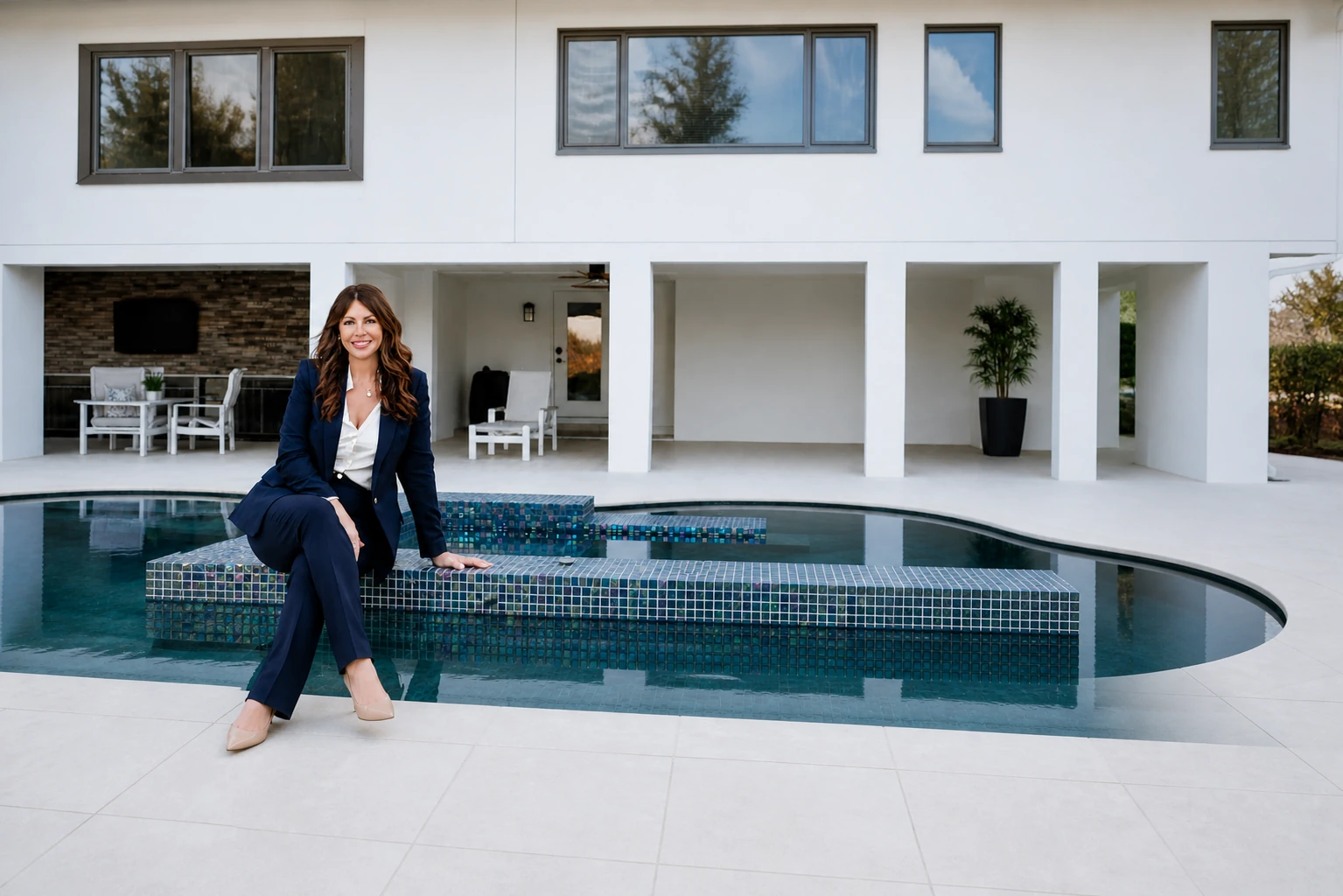
Now, before anyone panics, both of these neighborhoods are wonderful places to own a boat, and plenty of homes in each one have genuinely great access. I am not here to scare you off the water. I am here to help you ask sharper questions before you fall head over heels for a listing that just says “deep water” and calls it a day. I’m Liane Jamason, Broker/Owner of Corcoran Dwellings in St. Petersburg. I’ve represented waterfront buyers and sellers throughout Northeast St. Pete, including Shore Acres (former resident) and Venetian Isles
What Actually Decides Whether a Home Fits Your Boat
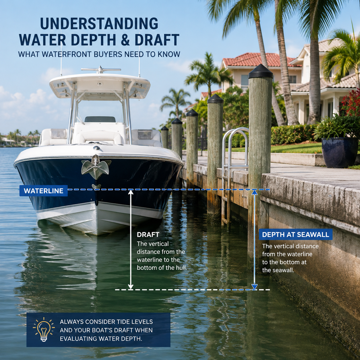
Start with your draft, which is just how far your boat sits below the waterline. A flats boat or a small center console might need a foot or two. A big cruiser or a sailboat can need four feet, five feet, or more. Your draft is the number every other measurement gets compared against, so know it cold before you look at a single canal.
Then there is the tide, and around here the tide is a character in the story, not a footnote. Much of Tampa Bay swings a meaningful amount between high and low water, and that swing is often the difference between gliding out and getting stuck. A canal that looks generous at high tide can pinch at low tide, so the real question is not just how deep the water is, but how deep it is at the lowest tide you would actually use. Depth at your dock matters too. Sediment loves to settle against seawalls and at the dead ends of canals, so the water right where your boat lives can be shallower than the middle of the channel. Measure it at the actual property. Do not assume. Best case scenario? We do the first showing by car. If you love the house, we do a 2nd showing WITH your boat. We take it there at high tide and see if you fit under any bridges we’ll have to contend with and make sure it fits. Take the guesswork out of it completely.
Bridges and lifts add a whole vertical layer that depth will never capture. Parts of Shore Acres in particular have low fixed bridges, and I mean low. Buyers constantly ask me for the exact height of a bridge, and the honest answer is that it is nearly impossible to give you one number. Clearance depends on where you measure and when. The water rises and falls with the tide, so a bridge that looks roomy at low tide gets a lot tighter at high tide, and the figure changes depending on whether you measure at the center of the span or out toward the edges. Treat any clearance number as a starting point and verify it for the tide and the boat you actually plan to run. A dock with a boat lift changes the math again, since the lift capacity and setup decide what can be stored out of the water, and seawall condition, age, and height factor in as well. This is exactly the kind of detail I dig into as a [waterfront listing specialist](/waterfront-listing-specialist/) working these St. Petersburg canals every week.
I learned this lesson firsthand when I lived in Shore Acres. We once took my 23-foot Starcraft hybrid deck boat out to the sandbar, which was only about a 10-minute boat ride from our house. I hadn’t watched my tide app closely enough, and on the way home we couldn’t get the boat under the bridge nearest my home on Dover. Fortunately, Shore Acres being Shore Acres (if you know, you know, everyone’s super friendly), we asked a neighbor on the other side of the bridge if we could tie up at their dock for a couple of hours until the tide dropped. They said, “Sure!” So we tied up the boat and hoofed it home. It’s a funny story now, but it’s also a good example of why I tell waterfront buyers that canal depth is only one part of the equation. Your boat’s draft, bridge clearance, tides, and the entire route from your dock to open water all matter.
Venetian Isles, Shore Acres, and the Run to Tampa Bay
It Is Not Just Your Canal
A deep canal only helps if the whole route to open water stays deep. Your boat may thread through several connected canals before it hits the bay, and the shallowest spot along that path is what really governs your access, not the water right behind your house.
That is why two homes on the very same street can offer completely different boating lives, depending on which way the water carries you toward Tampa Bay.
Strong Access, Still Verify
Venetian Isles is known for wide canals and lots of homes with direct or near direct access toward the bay, which is a big reason serious boaters love it. Even here, though, depth and clearance can vary street to street and tide to tide. A replacement of the Venetian Boulevard NE bridge has also been moving forward, so if your route runs under it, the current status and any updated clearance should be verified with the City of St. Petersburg.
Treat the neighborhood’s reputation as your starting line, then confirm the numbers for the specific home and the route you plan to run.
Great Value, Watch the Bridges
Shore Acres offers some of the more attainable waterfront in this part of St. Petersburg, and tons of homes have very usable water. Here is the insider part: I used to live here, so I can tell you first hand that some of the bridges are genuinely low. You are far more likely to slip a flats boat or a deck boat underneath than a bigger boat with a T-top, and some stretches are not sailboat accessible at all because the bridges are fixed and do not open. In parts of the neighborhood you also have to know the tides to get out to the sandbar and, just as importantly, to get back. This is why working with a local is so imperative. I know the difference between a home on a canal with a low bridge, vs one on more open water with no bridge obstacles.
Here is a real world example of why these numbers move. When the 40th Avenue NE bridge over Placido Bayou was replaced, its clearance reportedly went from around 8 feet on the old 1961 span to roughly 13 feet on the new one. That is a big jump, and it is exactly why an old rule of thumb about what fits under a Shore Acres bridge can be wrong today. Even so, treat any figure like this as approximate, since published clearances are measured to a tidal datum and the real number shifts with the tide. Verify the current clearance for your specific bridge and boat with the City of St. Petersburg, the U.S. Coast Guard Bridge Program, or NOAA charts before you count on it. Worth noting too: several bridges in and around Shore Acres are reportedly slated to be rebuilt, and in some cases raised, as part of the area’s flood and infrastructure work. Because those plans and clearances can change and timelines can slip, please verify the current status and any planned heights with the City of St. Petersburg before you count on them.
What to Verify Before You Buy a Waterfront Home
Before you commit to any waterfront property, run a short checklist tied to your actual boat, not to a listing description. The whole point is to confirm, in the real world, that the home works for the vessel you own or plan to buy.
1. Know your boat’s draft and overhead height, then measure both against the property and the route you plan to use.
2. Check water depth at the dock at low tide, not just at high tide or out in the middle of the canal.
3. Trace the full path from the dock to open Tampa Bay and find the shallowest point and any fixed bridges along the way.
4. Have the seawall, dock, and any lift inspected for condition, height, and capacity by a qualified professional.
5. Verify every one of these details for the specific address with the appropriate official source or marine professional, since conditions can change over time and depend on the individual property.
Keep one eye on the bigger picture too. There has been talk of dredging in some areas for storm and flood related reasons, on top of the bridge and infrastructure projects mentioned above. Plans like these can affect both depth and clearance down the road, so treat any of them as something to verify with the City of St. Petersburg or the appropriate agency rather than as a done deal.
And this is exactly why working with a realtor who knows these canals first hand is not a nice to have, it is imperative. A listing cannot tell you which bridges are low, which routes a sailboat will never clear, or where you truly need to read the tides to get out and back. That local knowledge is a core part of the [home search assistance](/home-search-assistance/) I provide for waterfront clients.
The Bottom Line for Waterfront Buyers
Before buying any waterfront property, I recommend verifying the water depth at the actual property and along the intended route based on your particular vessel. Do not rely on a listing that simply says “deep water.” That phrase means one thing to a flats boat and something completely different to a forty foot cruiser, and the only way to know for sure is to match the real conditions to your real boat.
Venetian Isles and Shore Acres both deliver beautiful waterfront living, and with a little homework up front you can land a home that fits your boating life for years. If you want a straight, no fluff walk through of a specific canal, dock, and route before you make an offer, that is my favorite kind of conversation. Reach out any time through my [buyer’s agent services](/buyers-agent/) or just [contact me directly](/contact/) and we will read the tide correctly together, while everyone else is still guessing at the chart.
FAQ: Canal Depth in Venetian Isles and Shore Acres
There is no single depth that covers either neighborhood. Canal depth varies by street, by where you are within the canal, and by the tide. What matters most is the depth at the specific property and along your route at low tide, measured against your particular boat’s draft. Every address should be verified individually.
Low tide is the number that really counts for most buyers. A canal that carries plenty of water at high tide can pinch at low tide, and low water is what decides whether you can come and go safely. It helps to know the depth at the lowest tide you would realistically use.
They can, and in some spots they really do. Parts of Shore Acres have low fixed bridges with limited overhead clearance that may restrict taller boats no matter how deep the water is beneath them. If you own a taller vessel, map your route and its bridges before you buy, and verify the clearances for your specific path.
This is one of the hardest questions to pin to a single number. Bridge clearance depends on where and when you measure, since the water rises and falls with the tide and the figure can differ from the center of the span to the edges. Rather than trusting one quoted height, confirm the clearance for that specific bridge at the tide stage and vessel you plan to use.
Several bridge and infrastructure projects have been reported in this part of St. Petersburg, including a replacement of the Venetian Boulevard NE bridge and work in and around Shore Acres, with some bridges potentially raised. There has also been talk of dredging in some areas for storm and flood related reasons. Plans and timelines can change, so please verify the current status and any clearance or depth details with the City of St. Petersburg before relying on them.
It depends on the exact location. Some sections of Shore Acres have low fixed bridges, and those stretches are often better suited to a flats boat or a deck boat than to a larger boat with a T-top. Certain waters are not sailboat accessible at all because the bridges are fixed and cannot open. If you own a sailboat or a taller vessel, confirm the clearance and the full route to open water for that exact address before you buy, ideally with a local agent who knows which canals work for your boat.
Not necessarily. “Deep water” means different things for different vessels and is never a guarantee for your boat. The depth that suits a small center console may not suit a larger cruiser or sailboat. Always confirm the actual conditions at the property and along the route for your particular draft and height.
Start with your boat’s draft and overhead height, then verify water depth at the dock at low tide, trace the full route to open water for the shallowest point and any bridges, and have the seawall, dock, and lift inspected by a qualified professional. Each of these depends on the individual property and should be confirmed for the specific address.
It varies by property. Venetian Isles has many homes with wide canals and strong access toward Tampa Bay, which can suit larger boats, but depth at the dock, seawall setup, lift capacity, and the route to open water still differ from one home to the next. Match a specific address to your boat’s draft and height rather than assuming the whole neighborhood fits one size, and verify each property individually.
For many boaters, absolutely. Shore Acres offers some of the more attainable waterfront in Northeast St. Petersburg, and plenty of homes have very usable water. The catch is that access is not uniform. Some canals have low fixed bridges and shallower stretches that favor smaller boats, while other areas offer easier passage to the bay. Knowing which is which for a given address is the whole game, so it helps to work with an agent who knows these canals first hand.
Your boat usually runs through one or more connected canals before it reaches open water, and the shallowest point and any fixed bridges along that path determine your real access, not just the depth behind your house. Two homes on the same street can have very different routes. Before buying, trace the exact path your boat would take and confirm depth and clearance along the whole way for your vessel and the tides you plan to use.
It is highly recommended. A listing can say deep water or direct access all day long, but it cannot tell you which bridges are low, which routes a sailboat cannot clear, or where you need to read the tides to get out and back safely. An agent with first hand knowledge of Venetian Isles and Shore Acres can help you match the right home to your actual boat and dodge a costly surprise after closing.
Thinking About a Waterfront Home in St. Petersburg?
If you are weighing a home in Venetian Isles, Shore Acres, or anywhere along the water in Tampa Bay, I would love to help you look past the listing language and check what really matters for your boat. Reach out and let’s talk through the property, the canal, and the route before you make a move.
Schedule Your Free Consultation




Leave a Reply